Keyhole Route
When John and I started our day, we did not yet realize that Long’s Peak would replace Middle Teton as our most challenging and dangerous hike.
We were camping at Glacier Basin Campground, so we accessed Long’s Peak via the Storm Pass Trailhead, making the already difficult day just a little bit longer. People typically start the hike up this monster at 2:30 am to make it off the summit before the threat of thunderstorms. An experienced hiker, who we had met on our hike up Castle in the Elk Mountain Range, said that we could probably start at 4; we were on the trail by 4:20.

The Boulder Brook Trail was a steady climb almost immediately, which was different than other western mountains we have hiked. There’s an extra excitement when hiking in the dark with only a narrow beam of light cluing you in on your surroundings. The sky was lightening up by the time we came to the switchbacks (I knew they would eventually show up). The switchbacks ended when we reached the krummholz, and that ended in tundra.
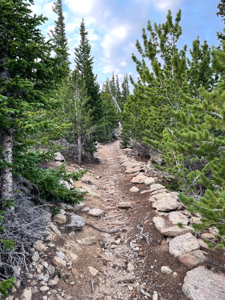

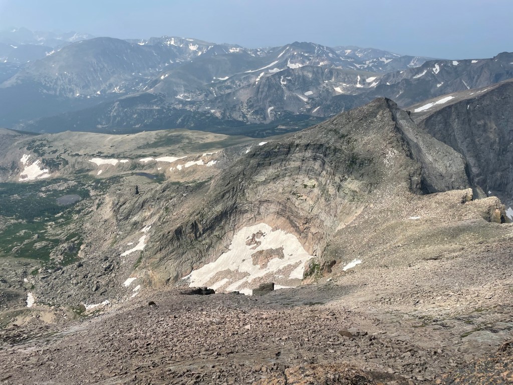
There was a decent rock trail for this meandering section of very long switchbacks that eventually got us to the “boulder field.” This reminded me of the terrain of the northern Presidentials in the White Mountains of New Hampshire. Since people can back-country camp at the boulder field, there were a couple of outhouses; these were a pleasant site to both John and me. The outhouses were unlike any I have seen before. The walls were composed of rocks inside of a rebar frame, but they did not go up high enough to offer the privacy that I am accustomed to. In addition to this, a couple was waiting to use the bathroom after us, like, right outside of the doors. It confused me as to why they would be so close.
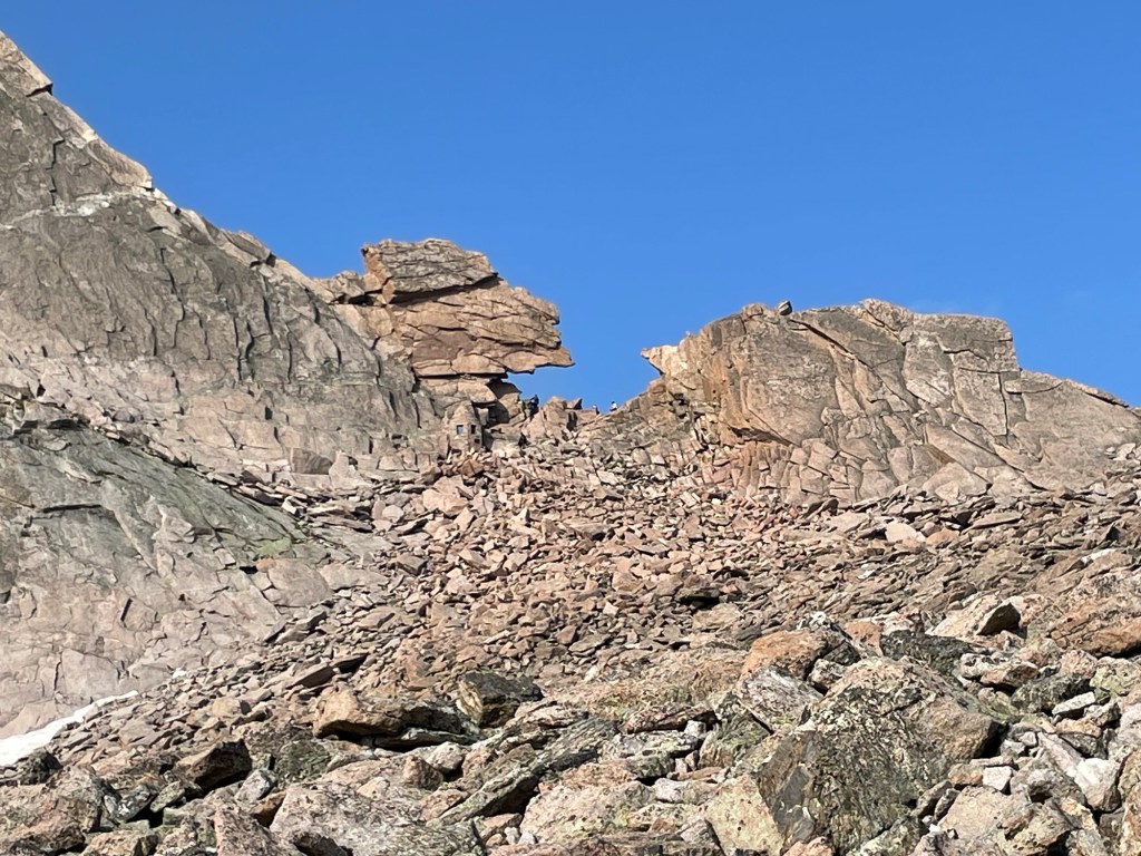
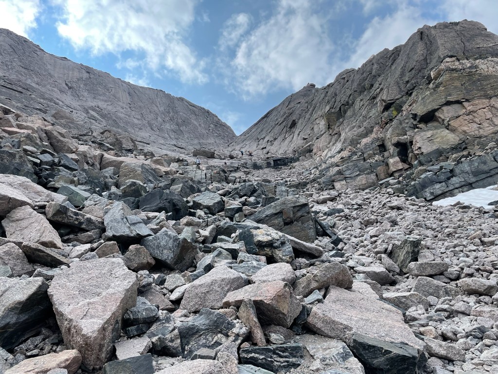
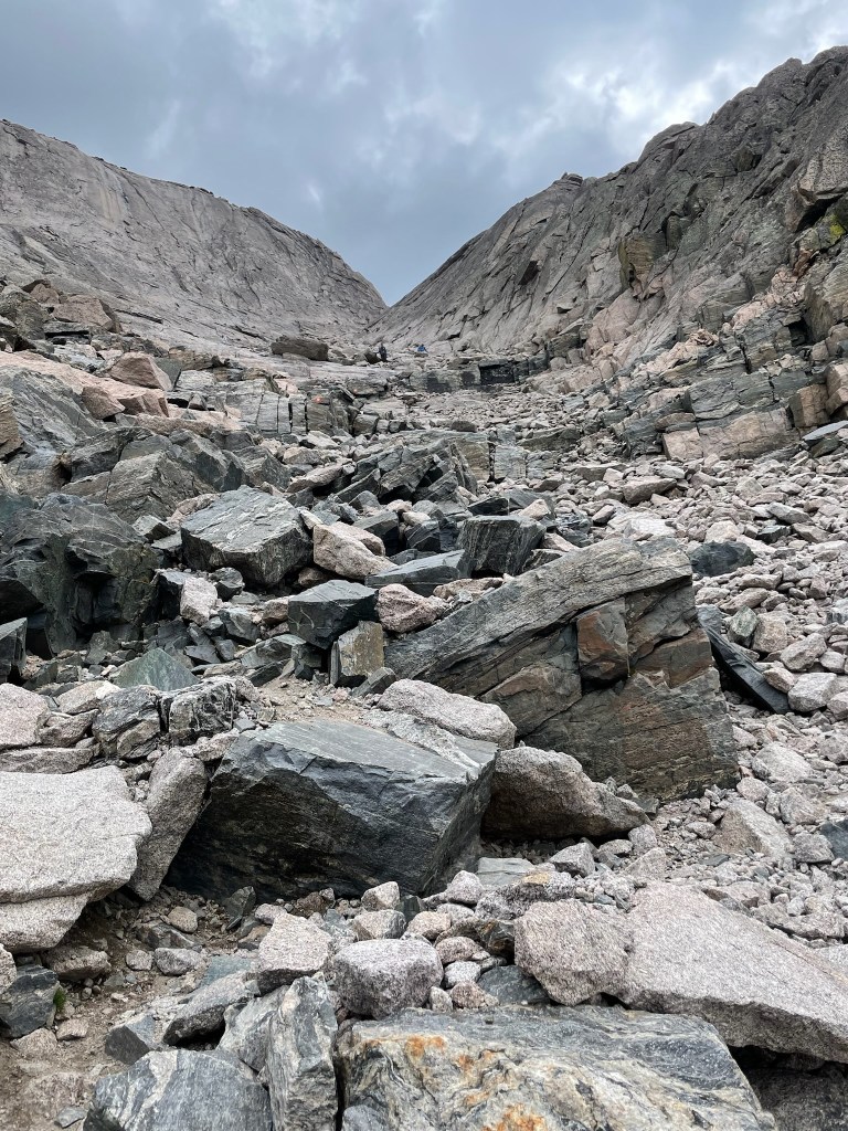
The boulder field was very much like what we’re used to in the whites: a giant talus field marked periodically by cairns. It was a steady, heart-pounding climb to the “keyhole,” a notch in the ridge, where the really fun stuff started.
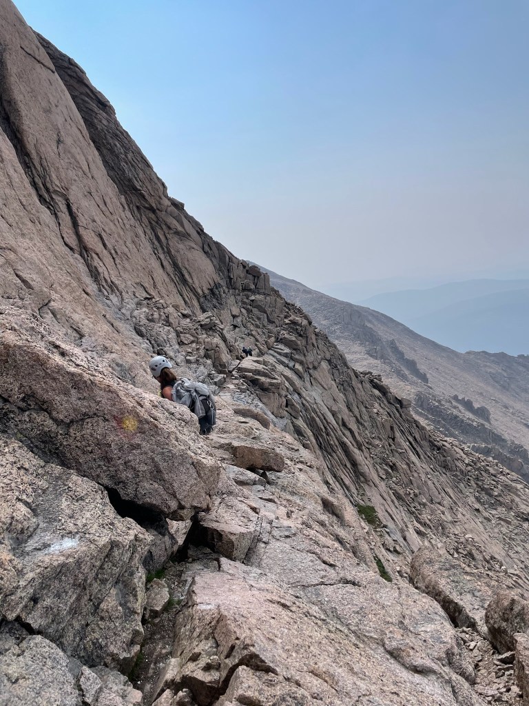
We were so grateful that the next section of the hike was marked by spaced-out bulls’ eyes on the rocks. This alleviated some of the stress of route-finding that tripped us up on our Wilson Peak hike. We traversed this part with trepidation because the exposure was more than we were used to; there was a many-thousand-foot drop-off, so we were vigilant with every step. I actually really liked this part, though. The next section, however, I could have done without.

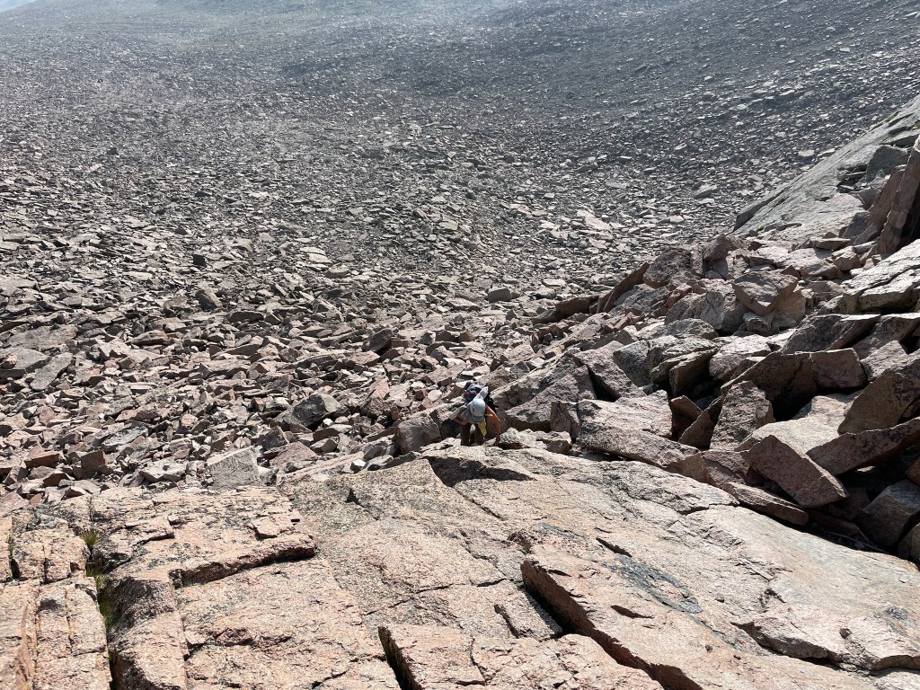
The “trough” is a gully of some stable/some unconsolidated talus, which climbs 600′, then an even steeper section for 30′ or so; this section seemed like it was never going to end. We were already wearing our helmets, but this would definitely be a place to put them on if we hadn’t been. I usually don’t stop on the up, but you couldn’t help it with the relentlessness of this push. And, of course, I was thinking of how the descent was going to be on this loose rock.
At the top of the trough there is a tricky scrambling part. I got into it with a young man who did not seem to know the trail etiquette that hikers going up have the right-of-way, and that it may not be the safest thing to have his party of seven guys all come down this tricky scrambling part while I waited at the bottom. I’m proud of how I advocated for myself, but I can image that they all think I’m a bitch. Oh well.
Now we were at the “narrows,” a exposed, narrow ledge. It was pretty easy to get through this section – there wasn’t any elevation change – but you had to watch those steps. The most annoying part of it all was moving over for people coming from the other direction; that’s when it could get dicey.
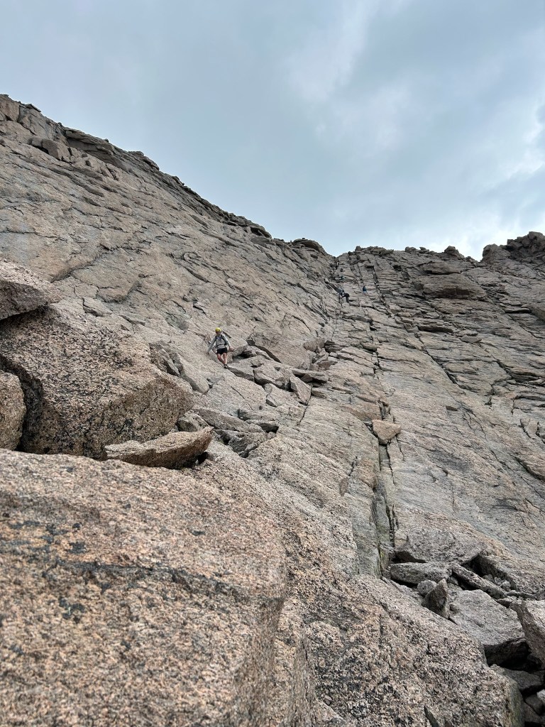
The “homestretch” is very intimidating when you’re at the bottom of it; it looks like smooth slabs on a steep pitch. For about 300′ of continuous climb, you are going from one hand- and foothold to another, hoping that there is another when you get there. Luckily it was dry or it would have been so much sketchier. And don’t even think about looking down behind you or you might shit yourself. Again, I thought about how in the world I was getting down this.

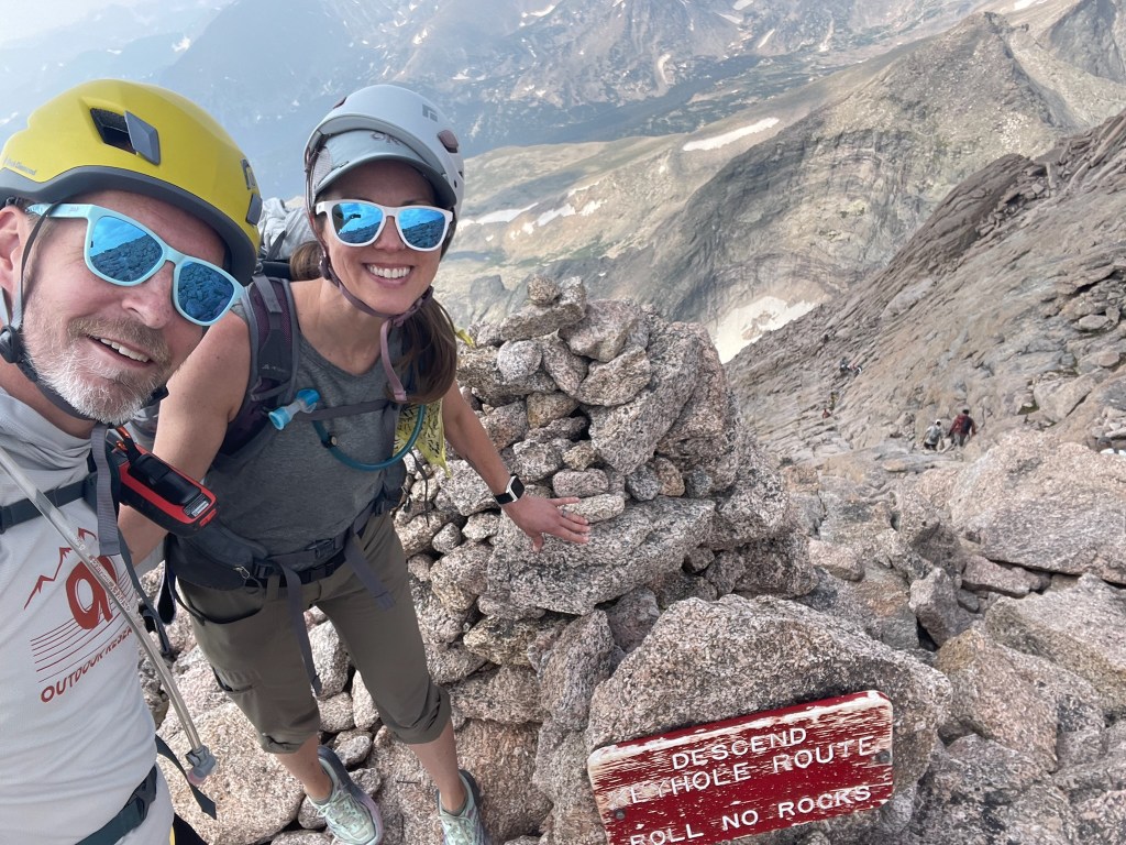
Other hikers, who were descending from the top, were telling us that what we saw wasn’t a false summit, and that we were just about there. That is exactly what you want to hear when you’re so exhausted and you know that you’re only halfway through your hike. John and I found a spot to sit and chill for a few minutes. There was a guy who we started chatting with who had just rock-climbed to the top; I’m always in awe of people who do that. He was cool, and there was another guy who kind of just moved over to join the conversation (we found people from Colorado to be so friendly). Soon we decided that it was time, and we all went our separate ways.
I won’t drag out this post by going through all of the descent. It was faster and easier than I thought it would be. Storm clouds were forming, so we had extra motivation. There were multiple moments of despondency from the both of us, especially when we got through all the hard stuff and the boulder field and STILL had eight miles to go. It really takes all your mental fortitude to push through when your ankles are sore from the shifting rocks; your head is feeling overheated, as well as the effects of the altitude, despite being acclimated; your shoulders are aching because you’re carrying extra weight for a long day; and the thought of eating the food you have left makes you nauseated. We did it, though, and don’t regret a second of it.
18-miles, 5,400′ of gain.
