Wildcat D, Wildcat, Carter Dome, South Carter, and Middle Carter
Saturday, June 21, 2025
Finally, a nice Saturday in New Hampshire! John and I wanted these five mountains but didn’t want to take two cars to spot, ride our bikes on Route 16, try to hitchhike, or do a 3-mile road walk. Instead, I dropped him off at the Imp trailhead, and I parked at the new Glen Ellis Falls lot and started up the Wildcat Ridge. We would meet at some point on the trail, then continue on our ways. Here’s my day through pictures.
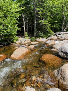
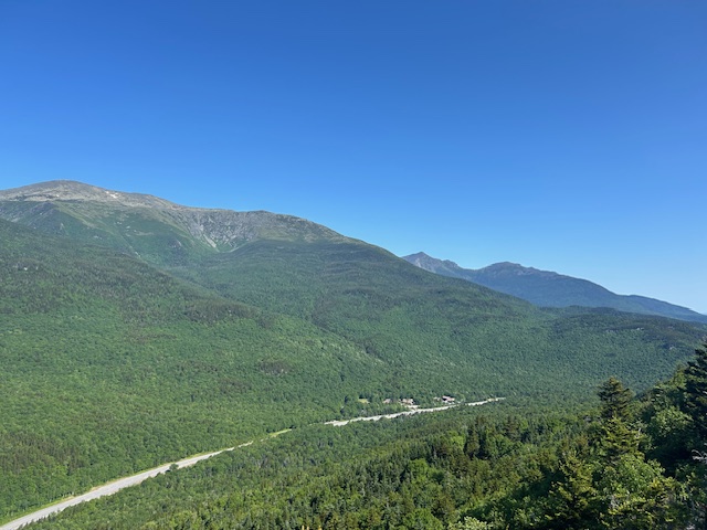
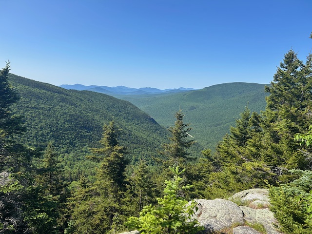
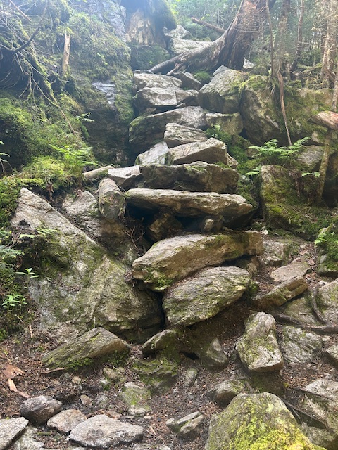
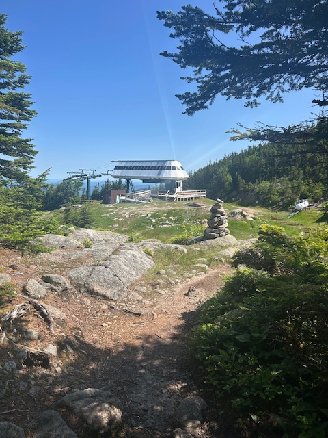
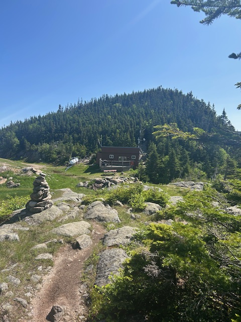
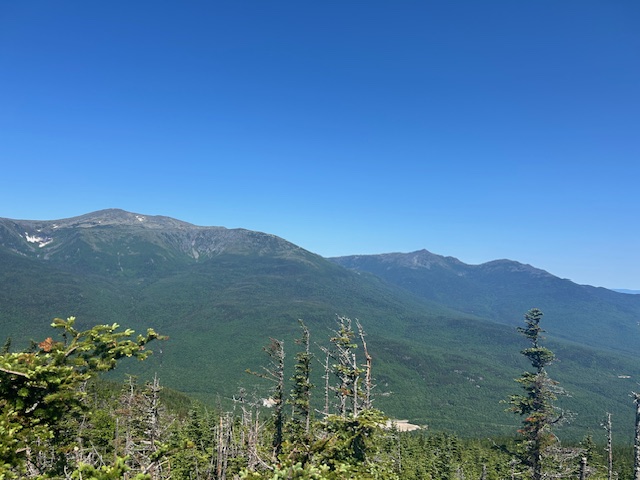
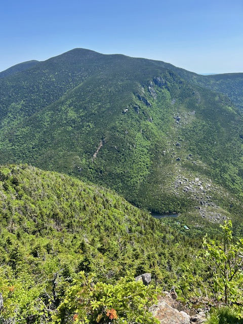
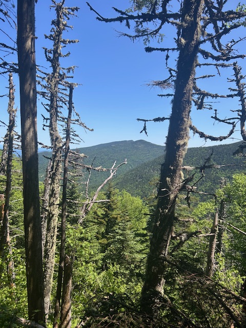
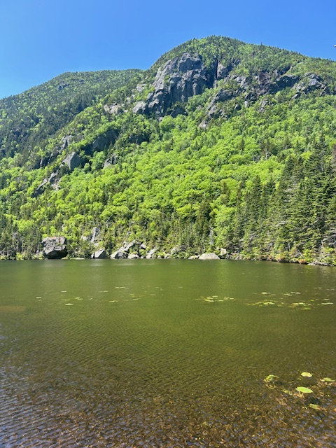
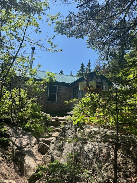
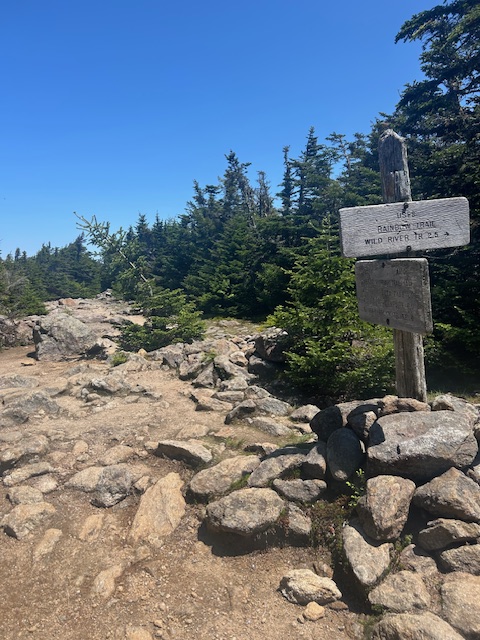
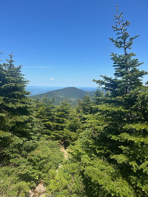
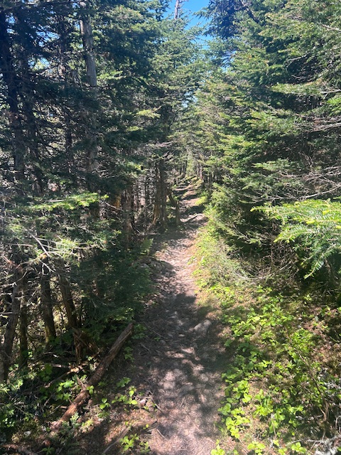
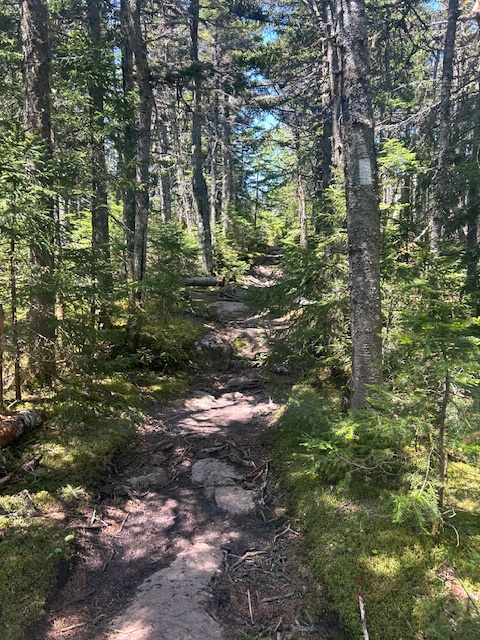
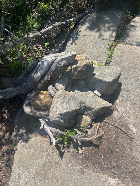
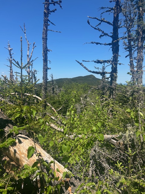
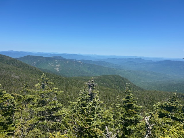
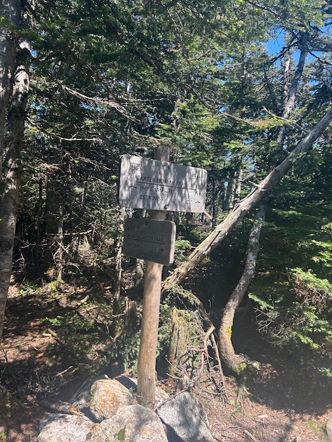
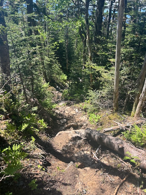
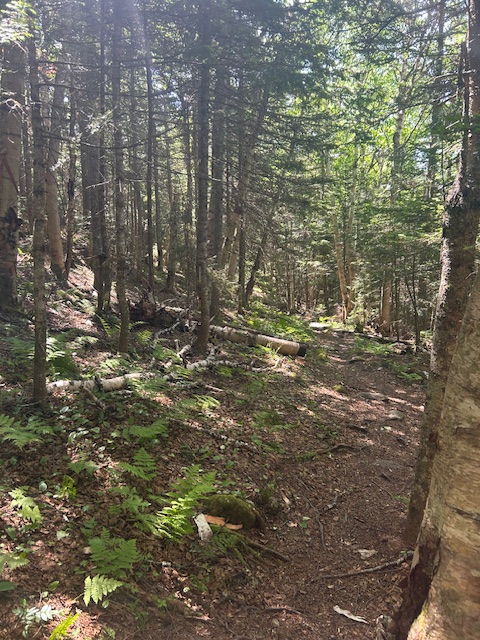
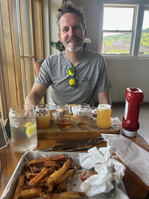
This is the only significant water crossing on the whole hike, and it’s right at the beginning. I took a lot of time deciding how to get across. I finally had to take a leap of faith to make it. What is a doozy for me would have been a piece of cake for John with his go-go-Gadget legs.The rugged trail starts climbing steeply right away. After three minutes, I got to the first view. You can see the new parking lot below, also Boot Spur and Mt. Washington.The view of Nelson Crag and Adams and Madison in the distance.This is the view looking south.One example of the fun on this trail.Most of this trail is rugged, and this is what I mean. There’s so much of this, that I couldn’t take pictures of all of it.At some point you’ll see this. It’s a great photo op if you want to pose like you’re holding up the boulder.More rugged trail.These steps are helpful, but when you reach the top of them, you have to keep climbing on the smooth rock that would be slick in the right conditions.This is what it looks like from the top of that climb.More semi-scrambling fun!A view of Washington’s summit, and another view of Adams and Madison. Route 16 is snaking through the notch.This is an example of a ridge hike: lots of roller-coastering. I just climbed a bunch, but now I’m going down without getting to the summit, yet. In fact, I still have distance to go.Steps trying to disguise the rough terrain.The top of the Wildcat Ski area.That’s the summit of Wildcat D.On the summit there’s a viewing platform. More views of the northern Presidentials (except for Jefferson).There are some big bridges on this trail. There’s definitely mud to navigate. Luckily it was pretty firm today, but even when it’s not, I do my best to not widen the trail by avoiding it on the sides. Sometimes you just have to walk through it.After quite a bit of up and down (there’s Wildcat C and B to go over, of course), I finally see Wildcat (A).This is from the viewpoint on Wildcat looking down at Carter Notch Hut. You can see Carter Dome and Hight peaking out on the left. I had plans to reapply sunblock while eating grapes and a molasses cookie while on the summit, but I started being attacked by black flies. So, instead of a nice time, I hurried to put on my hat and insect netting, put the cookie in my mouth and grabbed a handful of grapes. Meanwhile, half of the cookie fell on a rock and a gray jay took no time to swoop in to try to get it. Luckily I retrieved it before it could. I was so grumpy with this situation and started moving again.Time to head down the steep .7 miles to the notch.This is a view of Middle Carter, which I will be getting later.Wildcat Ridge trail ends at the junction with the Nineteen Mile Brook trail. Because of the bridge closure on the Madison Gulf trail, AT hikers have a detour that eliminates all the fun that I just had. Instead, hikers have been detoured to come up Nineteen Mile Brook and continue on the way I’m about to go. The next big leg of my hike is .2 miles around Carter Lake. I was able to reapply my sunblock at the hut. Thank goodness for a break from the bugs!Starting up the Carter-Moriah trail to get to Carter Dome. The first third is pretty much straight up. I didn’t get many pictures because I kept passing people, then when I did I had to make space so we wouldn’t leap frog. Eventually the trail isn’t as rocky like this, just a steady up. It was on the more gradual section that I saw John.Looking back at the hut and Wildcat on the other side of the notch.The summit of Carter Dome. Before reaching it, I was behind a man with a woman a short ways in front of him. I said “hi” with plenty of time so as to not be right on them. Usually people will say something like, “Hi. Oh let me move over. You’re faster than me.” Not this guy. He looked at me, kept walking, and told the woman in front of him that there was someone hiking faster than them. After a couple of minutes with me right behind them, they finally stopped. I thanked them (like a polite human being!) as I passed by. They said NOTHING. I don’t understand it…This is South Carter viewed from Carter Dome.This descent from the summit to Zeta Pass is delightfully gentle.Starting toward South Carter from Zeta Pass, the junction with the Carter Dome trail. I continued on the Carter-Moriah Trail. At some point on this .8 of a mile I met a NOBO AT hiker named “Nexis” who was very nice.This is the cairn on top of South Carter. There were people lounging around, so I took it and left. View of Middle Carter, my last mountain of the day.From Middle Carter, this is another view of the northern Presidentials, including Jefferson in the middle.This is the other side with the Baldface Mountains and then Maine in the distance.This is where I turn off of the ridge. No more elevation gain for me. Phew!Starting down the North Carter trail.For my entire hike down the North Carter, then Imp, trails I was the only one around. It was lovely!The last part of the hike. I should have taken a picture of John sitting in his camp chair by the car. He had been waiting 10 minutes for me. I finished this 14.5-mile hike of 6,000 feet of elevation gain in exactly 7 hours!John and I ate at Big Day Brewing in Gorham afterwards. My burger was delish!!


One response to “White Mountains, NH”
I loved reading this! Thanks so much for making the time to compose it
LikeLike